
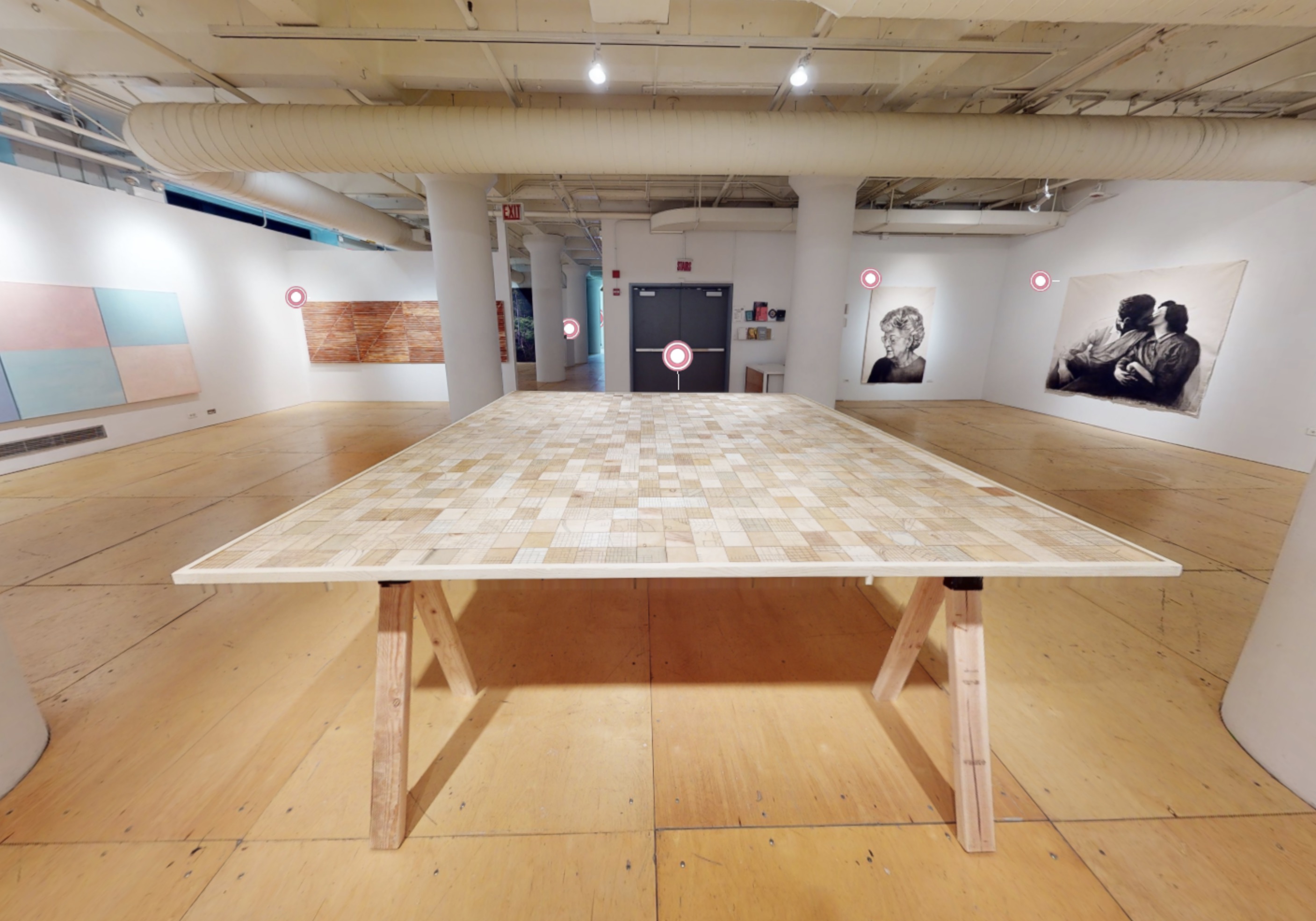
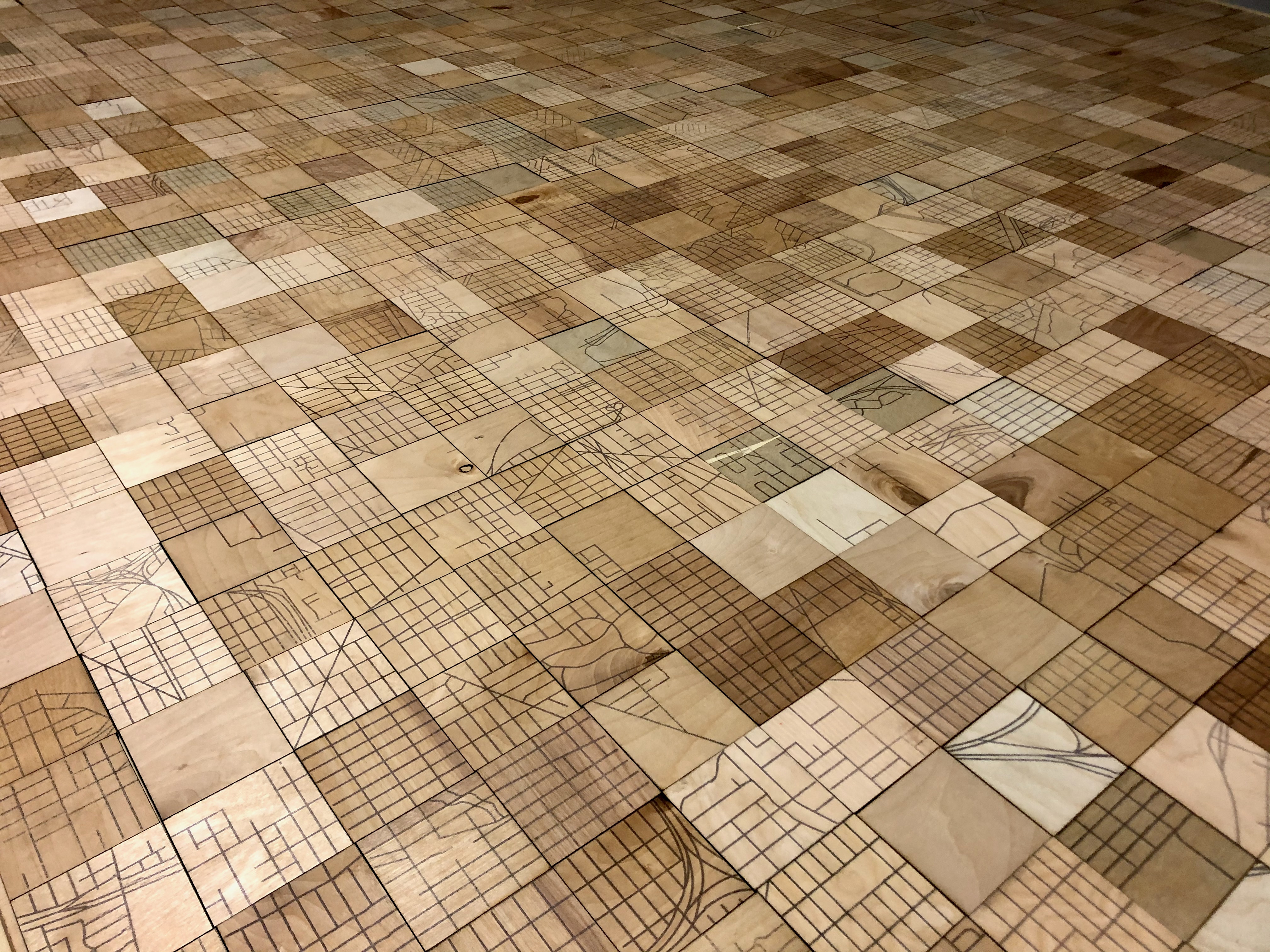
Map of Chicago (Superblocks)
Digital transfer on plywood, wooden table
2021
33” x 95” x 95”
Chicago’s basic form is a grid; specifically, a grid of half-mile squares called “superblocks.” These blocks correspond, more or less, to the paths of major streets, and to units of 400 in the city’s address numbering system. This has the effect of organizing the vast space of Chicago into manageable, orderly pieces, like cells in a spreadsheet whose contents are incidental to the system’s integrity as a tool.
In this piece, each 3” x 3” plywood tile maps the streets of one superblock. They are arranged on a square table in a random order, and can be rearranged by gallery visitors.